


Home › Industries › Energy and Utilities › Accelerating Trusted Geospatial Insights with ArcGIS Enterprise Modernization...
About Client
A regulated utilities group providing electricity transmission, distribution, and related infrastructure services across large, sparsely populated territories. The organization operates critical grid assets, supports capacity-expansion projects, and must comply with performance-based regulatory frameworks that influence capital allocation and cost recovery.
Its operations depend on geospatial systems for asset management, outage response, and infrastructure planning, creating an urgent need to modernize GIS platforms to maintain reliability, meet regulatory requirements, and scale for future renewable integration.
Market Trends in Power and Utilities
The national power sector is undergoing a major transition as renewable generation scales up, increasing variability on the grid and driving urgent demand for transmission upgrades and distribution modernization. Regulators are adopting performance-based frameworks that link permitted returns to reliability and efficiency, shifting capital toward resiliency, interconnection capacity, and future-proofing investments. Utilities are also accelerating digital initiatives such as ArcGIS Enterprise migration to enhance geospatial data management, improve grid planning, and support advanced analytics for a more resilient and sustainable energy infrastructure.
At the same time, utilities face growing operational complexity: integrating distributed energy resources, meeting stricter compliance and auditability requirements, and delivering faster response times for outage and asset management. These pressures are prompting utilities to replace legacy systems with cloud-ready, interoperable platforms that offer secure, auditable data flows, real-time analytics, and scalable performance. This geospatial infrastructure upgrade supports regulatory reporting, operational resiliency, and long-term sustainability goals while enabling advanced capabilities for grid modernization and digital transformation.
Business Challenges
The client relied heavily on ArcGIS Enterprise for asset management, outage response, and geospatial planning.
With ArcGIS 10.8.1 nearing its end of support in July 2026, the utility faced growing risks of security vulnerabilities, operational inefficiencies, and compatibility gaps with modern technologies. To address these challenges, the organization initiated an ArcGIS Enterprise migration strategy to ensure long-term stability, enhanced security, and improved integration with advanced geospatial tools.
To future-proof its geospatial infrastructure in the future, the client needed to address multiple technical and operational challenges:
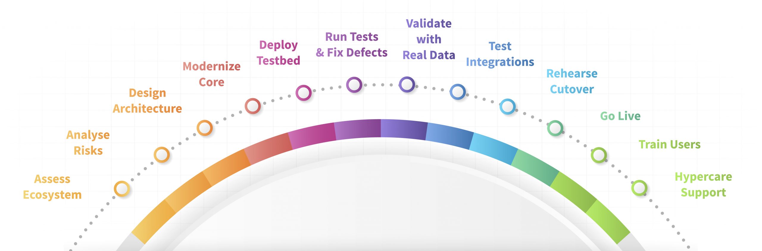
LTIMindtree Solution
LTIMindtree partnered with the client to strategically upgrade its ArcGIS Enterprise platform from 10.8.1 to 11.1.
The initiative was designed to modernize the utility’s geospatial infrastructure, mitigate critical support and security risks, and ensure alignment with Esri’s long-term roadmap. A structured approach emphasized detailed assessment, risk management, and seamless execution to avoid operational disruption. As part of this strategy, the organization prioritized a comprehensive geospatial infrastructure upgrade to enable scalability, improve system performance, and support future digital transformation initiatives.
Technical Architecture Diagram

Figure 1: Technical Architecture Diagram
Business Benefits

Reduced technical debt by 15–20% through Python modernization
Migrated 9+ complex scripts from Python 2.7 to 3.9, eliminated deprecated code, and adopted modern ArcPy features for better maintainability.

25% faster enhancement cycles with improved maintainability
Streamlined debugging and efficiency, reducing future enhancement effort.

Zero disruption during testing through parallel testbed deployment
Enabled uninterrupted operations while accelerating validation cycles, cutting QA effort by 20–25%.

Greater deployment confidence with early issue identification
Minimized rework and accelerated readiness.

Seamless production cutover with minimal downtime
Executed DNS redirection and validation within hours, preventing business impact.

Reduced rollback and troubleshooting effort
Saved multiple person-days by avoiding rework and ensuring operational stability.

40% drop in support tickets post go-live
Achieved rapid issue resolution during a 4-week hypercare phase, boosting user satisfaction.

Accelerated platform adoption through user enablement
Delivered training and documentation that reduced onboarding time by 30% and increased self-service capabilities, improving productivity by 15-20%.
Conclusion
The client strengthened its geospatial backbone with a secure, scalable, and future-ready system by modernizing its ArcGIS Enterprise platform. This geospatial infrastructure upgrade reduced operational risk and positioned the utility for ongoing innovation, faster response to grid demands, and long-term business continuity.
Future-proof your geospatial systems with LTIMindtree.
Discover how we can help you modernize critical platforms, ensure resilience, and unlock faster innovation.
Connect with us at EUgene.comms@ltimindtree.com
